
Conservation At Camp: Watershed Health at the Bar 717 Ranch
Happy Friday, and welcome to the third installment of our #ConservationAtCamp series, where we’re talking about the major land management topics that guide our stewardship of the Bar 717 Ranch and the projects we’ve undertaken to address them. This week, we’re focusing on watershed health!
An Introduction to the South Fork Trinity River Watershed
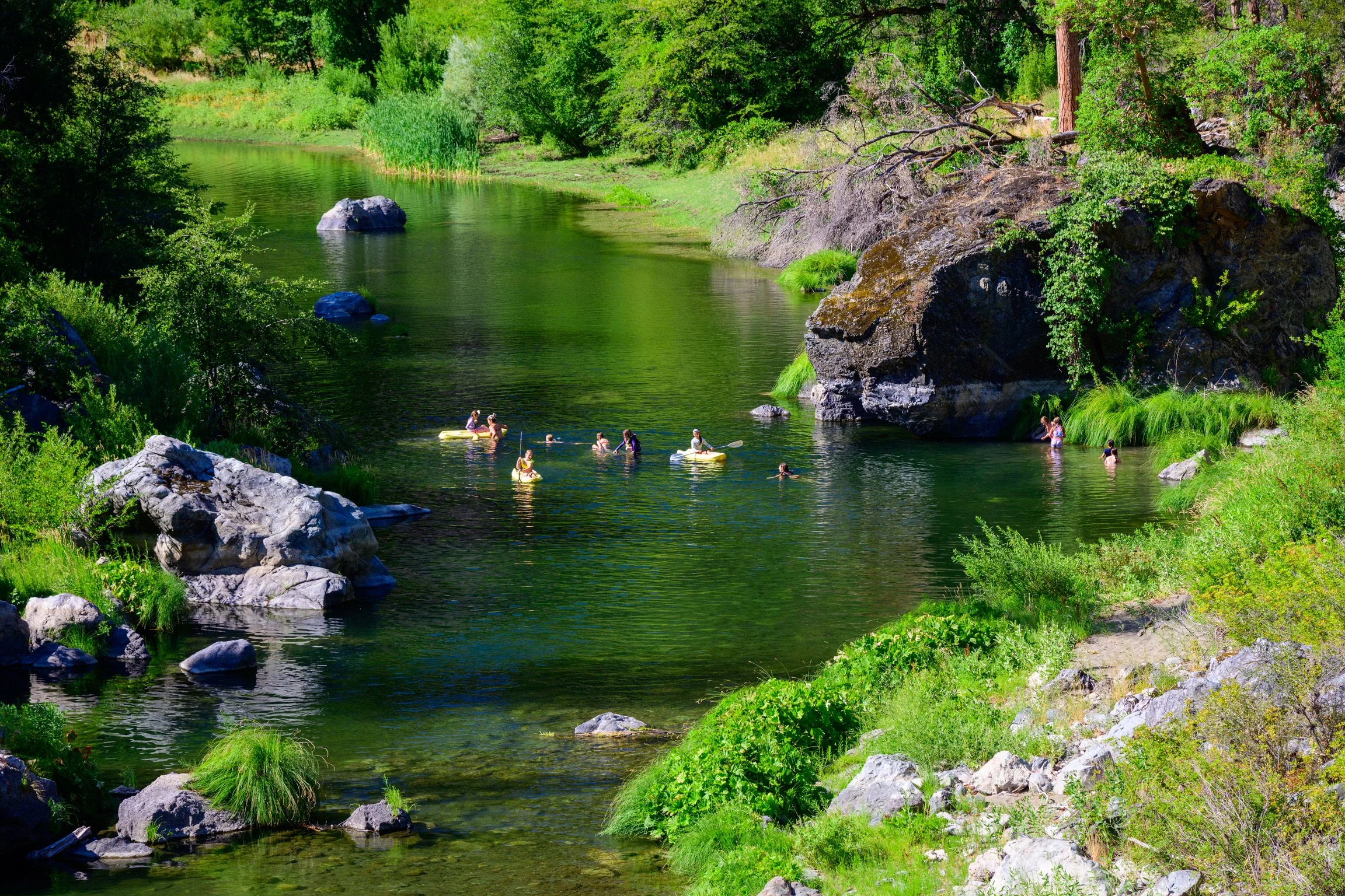
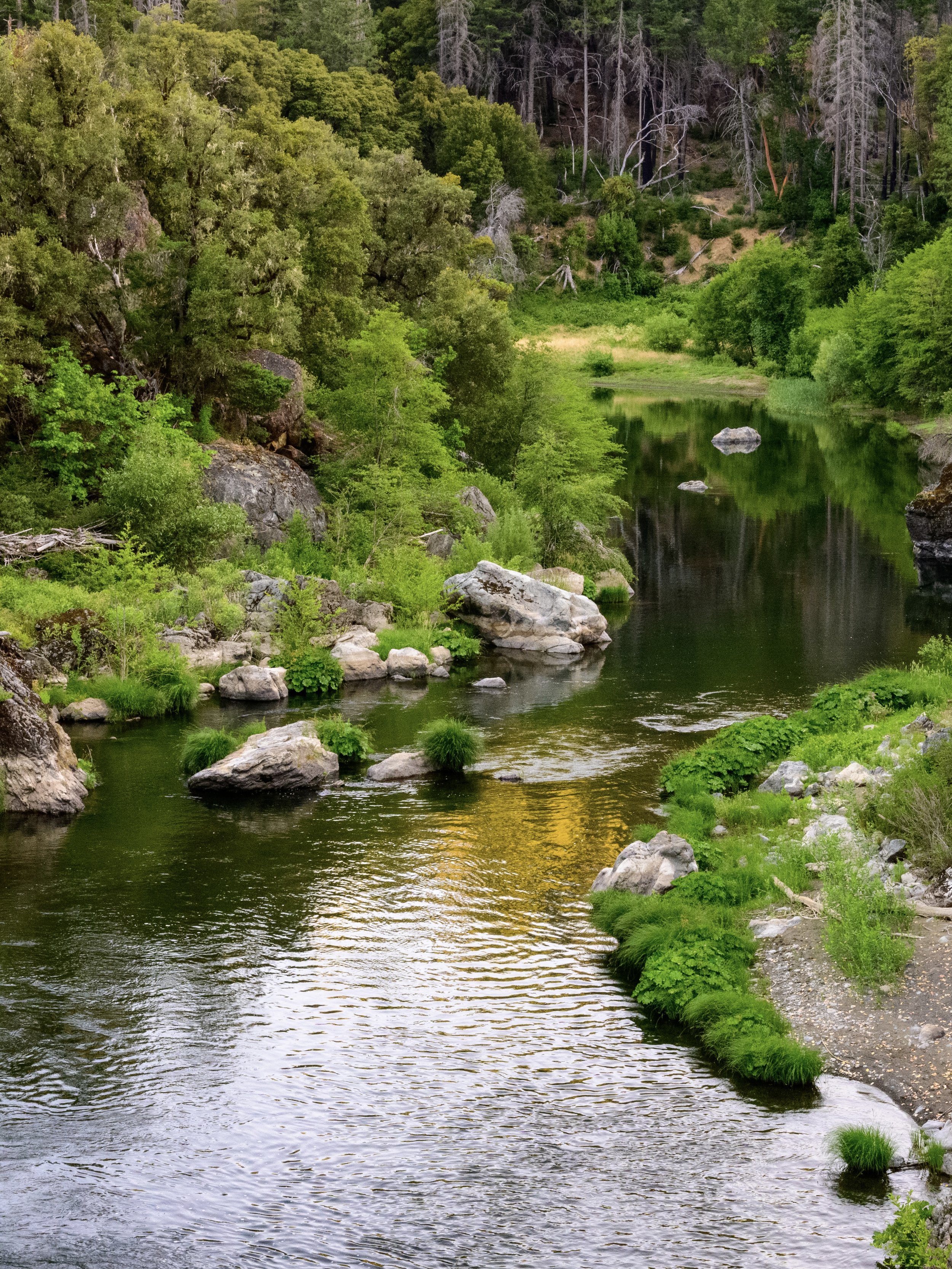
If you’ve visited the ranch, you’ve likely been to the swim hole: our much-beloved spot on Hayfork Creek just down the hill from Main Camp, perfect for cooling off on hot days. In the late 1800s when this area was first homesteaded, access to water was a primary factor in deciding where homesteads were established. Our proximity to water is not due to luck or coincidence – instead, we have the original residents of this property to thank for their wisdom in choosing this location.
Hayfork Creek bisects the ranch, and is the main tributary of the nearby South Fork Trinity River (SFTR). The SFTR remains one of the largest un-dammed river systems in the state of California, and the wider SFTR watershed covers an area of approximately 932 square miles. The SFTR watershed supports an incredible amount of biological diversity, including valley grasslands, forests of pine, oak, cedar, fir and madrone, and subalpine habitats that are home to a vast array of native flora and fauna – over 300 bird species alone live in the area year round or utilize it during migration.
The SFTR also hosts populations of coho salmon, fall and spring runs of Chinook salmon, and summer and winter runs of steelhead trout. These fish species are all anadromous, meaning they are born in freshwater, migrate to the ocean to mature, and return to their freshwater birthplace to reproduce. These fish populations were once abundant in the Trinity River and Klamath River (of which the Trinity River is a tributary); the spring run of Chinook salmon alone historically totaled over 100,000 fish annually. Things look a little different today, however, with all three fish species either diminishing or already heavily diminished. Coho salmon are scarce and at high risk of extinction in the SFTR, while steelhead trout populations are shrinking and spring-run populations of Chinook salmon are at about 10% of their historical numbers.
This significant decline in fish populations in the SFTR watershed is largely due to lower water flows, warmer water temperatures, and loss of habitat needed for spawning – factors that are, unfortunately, a result of the heavy impact that land use and management practices have had on the watershed over the last ~150 years.
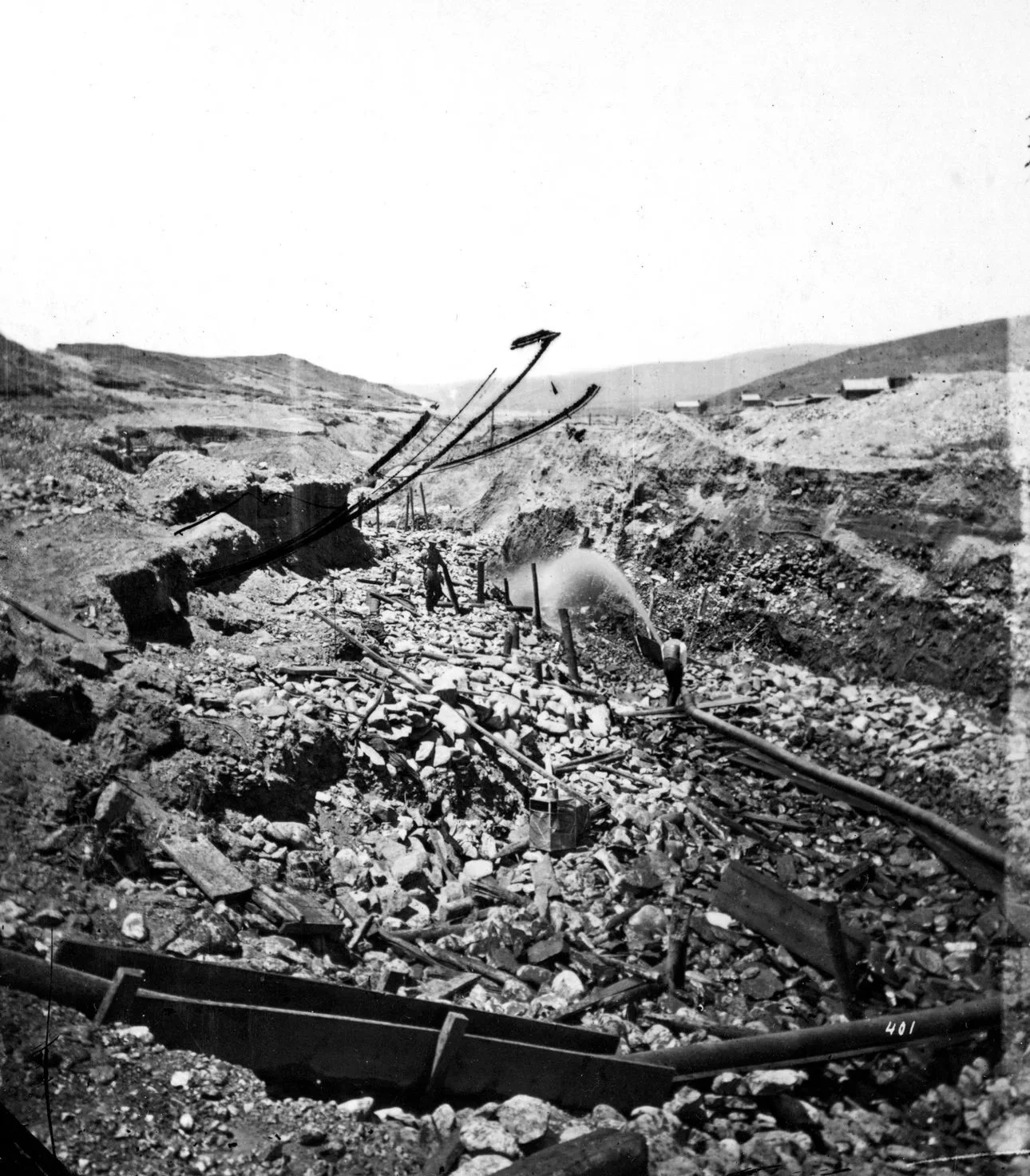
A visual of the type of hydraulic mining techniques used historically in the Hayfork Valley area.
"Hydraulic mining near Virginia City. Madison County, Montana. 1871" by U.S. Geological Survey is marked with CC0 1.0.
As we’ve discussed in our previous installments, European settlement of the SFTR region began in the mid-1850s with the discovery of gold, and the area was soon developed by mining, ranching, farming, and logging. In particular, mining in the area was intensive, and early practices such as hydraulic mining (which uses pressurized water to slough away hillsides and reveal gold deposits) caused significant environmental damage in the form of flooding and massive amounts of sediment deposits into nearby watersheds.
Road building associated with the logging industry, which was booming during the 1940s-1980s, has also significantly contributed to erosion and increased sedimentation throughout the watershed.
This heavy sediment load alters natural stream channels and destroys important salmon habitat, filling deep, cool pools used during migration, covering gravel beds used for spawning, and smothering eggs. Logging (alongside other land clearing practices such as grazing) also reduces stream shade and increases water temperature. At the same time, increased diversion of water from the SFTR for irrigation and domestic usage have reduced water flow, in conjunction with changes in weather and rainfall patterns due to climate change.
Despite these environmental concerns, the good news is the SFTR does still support a wild, self-sustaining (if decreased) Chinook salmon population, one of only a few river systems to do so. There have been widespread, ongoing efforts in the region to restore the watershed and its fisheries — particularly the spring run of Chinook salmon — in the form of water conservation, water quality monitoring, erosion control, and fuels management. While much of this work takes place on public lands, what happens on privately owned land such as the Bar 717 also significantly impacts watershed health, and it’s been a central focus for us over the years to make sure that we prioritize our water systems.
Our Projects & Partnerships
In last week’s post, we discussed the 1999 survey we carried out with the California Department of Forestry and Fire Protection (CAL FIRE) to build a comprehensive environmental management plan, and how the survey concluded that our primary focus areas were fire mitigation and water quality. While we focused exclusively on fire mitigation last week, the reality is that these things are deeply intertwined, and nearly everything that happens on a landscape ultimately affects water quality and watershed health.
Fuels Management & Erosion Control
As we’ve learned, one of the main issues that the SFTR watershed faces is erosion and sedimentation that destroys important riparian habitat. The fire mitigation work we continue to perform – manual brush clearing as well as prescribed burning – helps us improve forest health and fire safety on the property, but it also indirectly helps us reduce erosion and manage runoff into our watershed. Our ecosystem evolved alongside fire, and prior to European settlement was adapted to regular, lower-intensity fires. However, the higher intensity fires that we’ve seen in California in recent decades have contributed heavily to increased sedimentation in waterways that house critical salmon habitat: the fire event itself produces large amounts of debris and sediment, and burned areas experience higher levels of erosion and runoff for months following the fire.
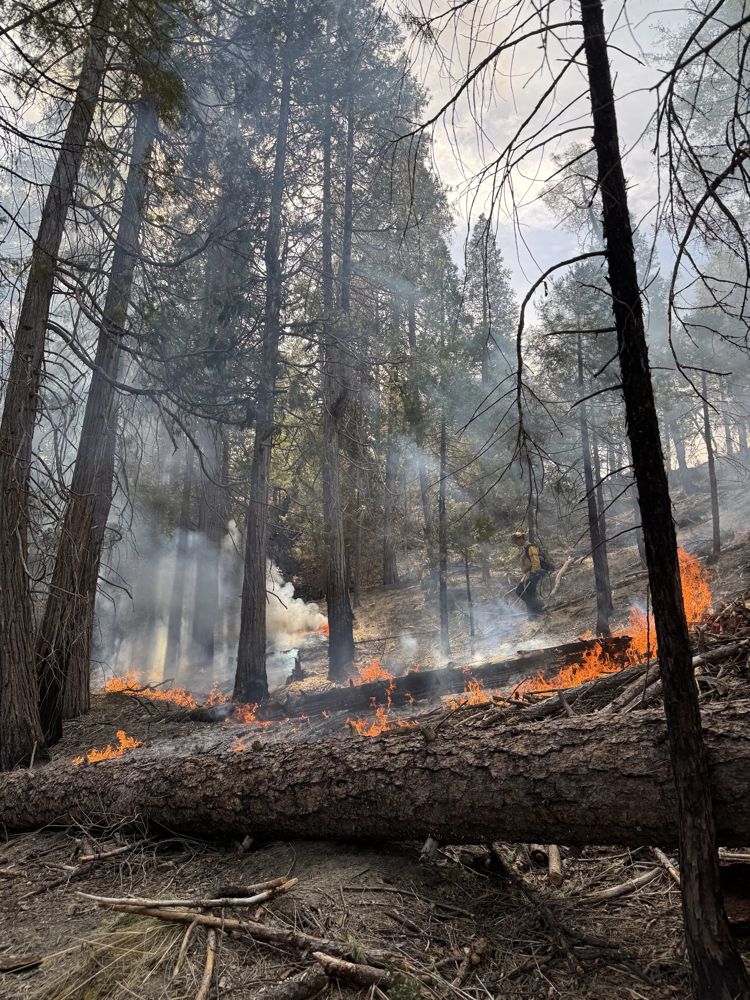
Because of this, fire mitigation efforts are an extremely important factor in maintaining watershed health. By minimizing our fuel load and carrying out prescribed burns to reduce the risk of high-intensity wildfire, we are also ensuring that erosion and sedimentation into nearby waterways such as Hayfork Creek remain at normal, healthy levels for salmon and other aquatic residents.
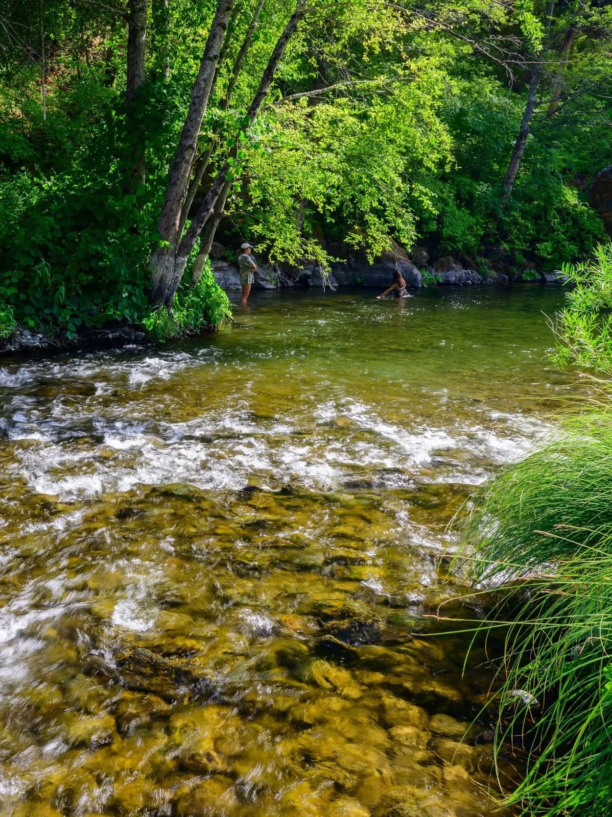
In addition to fire mitigation, some of our projects have had a more obvious connection to watershed health. In our initial partnership with CAL FIRE, we worked on replanting previously logged areas across Hayfork Creek, helping to reduce erosion by anchoring soil with new root systems and providing increased shade and ground cover. We also worked to re-establish natural stream channels at Girls’ Camp, another favorite Hayfork Creek swim spot near Main Camp. In the early 1960s, this area of the creek had been diverted in order to build a wide, flat landing for a logging collection point – a place where logs were brought out of the forest and staged to be loaded onto trucks. This required moving extensive amounts of earth, obstructing original stream channels that we later restored.
With the support of CAL FIRE as well as the NRCS and TCRCD, we have also done extensive work on pasture replanting, fencing, and road maintenance. Roadbuilding techniques in particular have a significant impact on water quality. We have approximately twenty miles of roads across the ranch, nearly all built in previous decades by logging crews. In the past, there was little consideration of how road construction contributed to erosion and increased sedimentation. Most were built with in-sloped drainage, meaning water collected in ditches on the uphill side of the road and funneled into culverts. This higher concentration of flowing water during winter storms resulted in an increased amount of eroded sediment deposited into creeks and rivers.
In the winter of 1964, a series of extreme winter storms caused massive flooding in the Hyampom Valley and surrounding regions. The South Fork Trinity River overflowed its banks, filling the valley’s farmlands with sediment, destroying topsoil and replacing it with gravel. This also heavily increased the sediment load in the river itself, smothering salmon eggs and important habitat used for spawning. This extreme sedimentation was attributed in part to the extensive, unregulated road construction associated with logging across the region, and the event was a major catalyst for the subsequent increase in road building regulation in California.
Since then, we have put significant effort into re-building roads to reduce erosion and sedimentation. This has involved re-grading roads from an in-sloped to an out-sloped design. Out-sloped roads direct all water from the road to the downhill side, where it is dispersed more evenly and re-absorbed into the slope below the road. We also “rocked” our entire road system, applying a layer of crushed shale to road surfaces. The shale (a rock-clay mixture) packs down tightly, armors the surface of the road to guard against erosion, and allows the road to be used even during the rainy season. These design changes help mitigate the creation of erosive gullies and minimize sediment-filled runoff. Most of us don’t spend a lot of time thinking about the ranch roads (beyond appreciating that they allow us to travel across the property more easily!), but alongside fire mitigation work, road maintenance is incredibly important to maintaining the health of our creeks and rivers.
Water Use on the Ranch
Overall, we have a good water supply on the ranch – we are well placed near multiple water sources (thanks again to the property’s original homesteaders!), and our primary water rights go back to 1894. Our main water source comes from Grassy Flats Creek, which runs from above Main Camp through the Homestead and into Hayfork Creek. Water from the creek is diverted, separated for irrigation use, and filtered for domestic use. We also have separate diversions from Grassy Flats Creek lower on the property for irrigating Barn Hill and the Homestead.
Though this water supply remains strong year-round, conserving as much water as possible is a central priority. All of our diversions return any unused water directly to the creek, and our ditches and surface irrigation are carefully maintained to limit leakage and water waste.
Over the years we have also upgraded our infrastructure to be more efficient (such as installing low-flow toilets), and we regularly invest time in educating our staff in appropriate water use. Water is an important topic on the first day of staff training every summer: we teach our team how to identify and fix water leaks, and depend on them throughout the season to help us maintain our water systems.
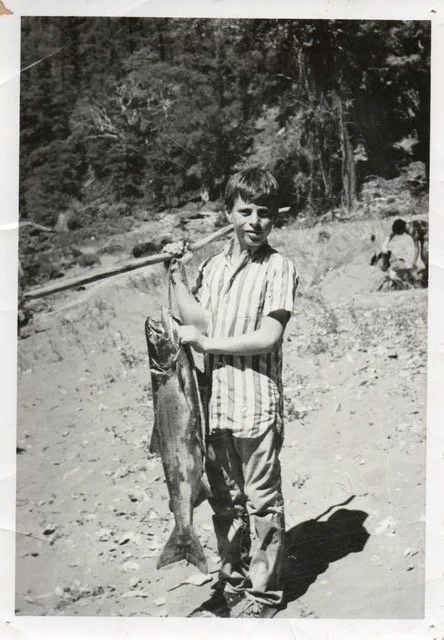
A fish caught near Diamondback Beach at the ranch, 1962.
Photo shared by John Rapf.
Water Quality Monitoring & Fish Hatcheries
Water quality monitoring is also an important facet of watershed health and restoration projects, and for many years we’ve worked with the Watershed Research & Training Center (WRTC) – our neighbors in Hayfork and prescribed burn partners – to monitor Hayfork Creek and nearby Corral Creek. Generally, water quality monitoring involves taking samples to test basic parameters such as water temperature, pH (the acidity/alkalinity of the water), turbidity (the amount of suspended particles in the water, such as algae or sediment), stream flow, and dissolved oxygen (the amount of oxygen molecules available in the water). These tests give us a snapshot of watershed health, tell us how livable our waterways are for salmon and other animals, and can identify any issues that need to be addressed. Chinook salmon in particular are considered an indicator species: they are highly sensitive to the impacts of climate change and other stressors, and rely on clean, cold water to spawn during the warmest months of the year.
Beyond providing a general picture of watershed health, monitoring things like turbidity and dissolved oxygen is incredibly important for fisheries restoration work, because it tells us if our creeks are capable of supporting Chinook salmon populations. Currently, the WRTC is looking into using Girls’ Camp as a location for a remote stream incubator, or RSI, for Chinook salmon. RSIs are essentially miniature fish hatcheries: fertilized salmon eggs are placed in a stream-fed incubator (typically a small barrel), and are allowed to hatch and develop before being released into the stream itself.
This process allows young salmon to adjust physically to the water properties of the stream, with the ultimate goal of the RSI location becoming their natal stream that they will eventually return to for spawning. Because of the work we’ve done to support watershed health, and because we already have a well-established irrigation and water control system on the ranch, we’re well set up to support this kind of project. So far, RSIs have been tested throughout Weaverville, Hayfork, and Hyampom, and we’re excited to see this work continue to support a healthy, growing population of Chinook salmon in our creeks.
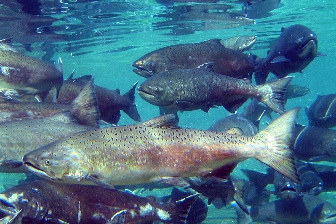
"Chinook Salmon" by Pacific Northwest National Laboratory - PNNL is licensed under CC BY-NC-SA 2.0.
Each summer on the ranch, we’re reminded (especially on the hottest days) how incredibly valuable our waterways are. They keep us cool, provide us with water for drinking, cooking, growing food, bathing, and irrigation, and support the incredible amount of wildlife that call these mountains home. The collective positive influence of erosion control projects, prescribed fire, water quality monitoring, and fisheries restoration demonstrates how interconnected all aspects of land management are: forests, fires, waterways, and human inhabitants working together towards the common goal of a healthy ecosystem for generations to come.
Next week, we’ll be discussing the final piece of our land management puzzle: grazing and livestock management. We’ve mentioned grazing and livestock briefly in each of our posts so far, and our fourth post will be a chance to deep dive into the topic and tie it all together. Tune in next Friday to learn about pastures, soil health, rotational grazing, and more!